

Go road-tripping across America with four-time poetry Pulitzer prize winner Robert Frost, and this is what happens: At every fork in the road, he chooses the road less traveled. And so you end up on each state’s loneliest road.
Actually, that’s not how this map came about. It owes more to bureaucratic bean-counting than to poetic obstinacy. Telematics specialists at Geotab gathered 2015 data from the U.S. federal government’s Highway Performance Monitoring System (HPMS) to find, for each state, the route with the lowest annual average daily traffic (AADT). HPMS data covers interstates, U.S. routes, and state routes over 10 miles long. That excludes Washington, DC, by the way. (The nation’s capital apparently doesn’t feature any major road of at least that length.)
Here are the top five:
#5. South Dakota. State Route 73 (255 miles, from Lemmon, on the North Dakota state line, to Martin, on the Nebraska state line). AADT: 556.
#4. Nevada. State Route 360 (23 miles, from Dyer to Mina). AADT: 517.
#3. Montana. State Route 19 (21 miles, from Grass Range to Roy). AADT: 489.
#2. North Dakota. State Route 24 (211 miles, from Fort Yates to Solen). AADT: 242.
#1. Alaska. State Route 11 (414 miles, from Fairbanks to Deadhorse). AADT: 196.
With an AADT of 196, that means on an average day, you will be one of fewer than 200 drivers barreling down AK-11, many of them ice road truckers. For context, America’s busiest road is the I-5 stretch in the Los Angeles-Long Beach-Santa Ana metro area (*), which in 2019 had an AADT of 504,000.
With its minimal measure of motorists, Alaska State Route 11, a.k.a. the Dalton Highway, truly is the loneliest road in America — despite the claim laid to that title by U.S. Route 50 in Nevada, which also features on the list, but doesn’t even break the top five.
Granted, with an AADT of less than 1,000, the stretch of U.S. 50 that crosses Nevada — following the old Pony Express trail across the state’s empty middle — isn’t a very busy one. But surely its traffic count has shot up since July 1986, when Life magazine proclaimed it “The Loneliest Road in America.” Yet another attraction ruined by the very tourists coming to experience it.
Lonely but pretty
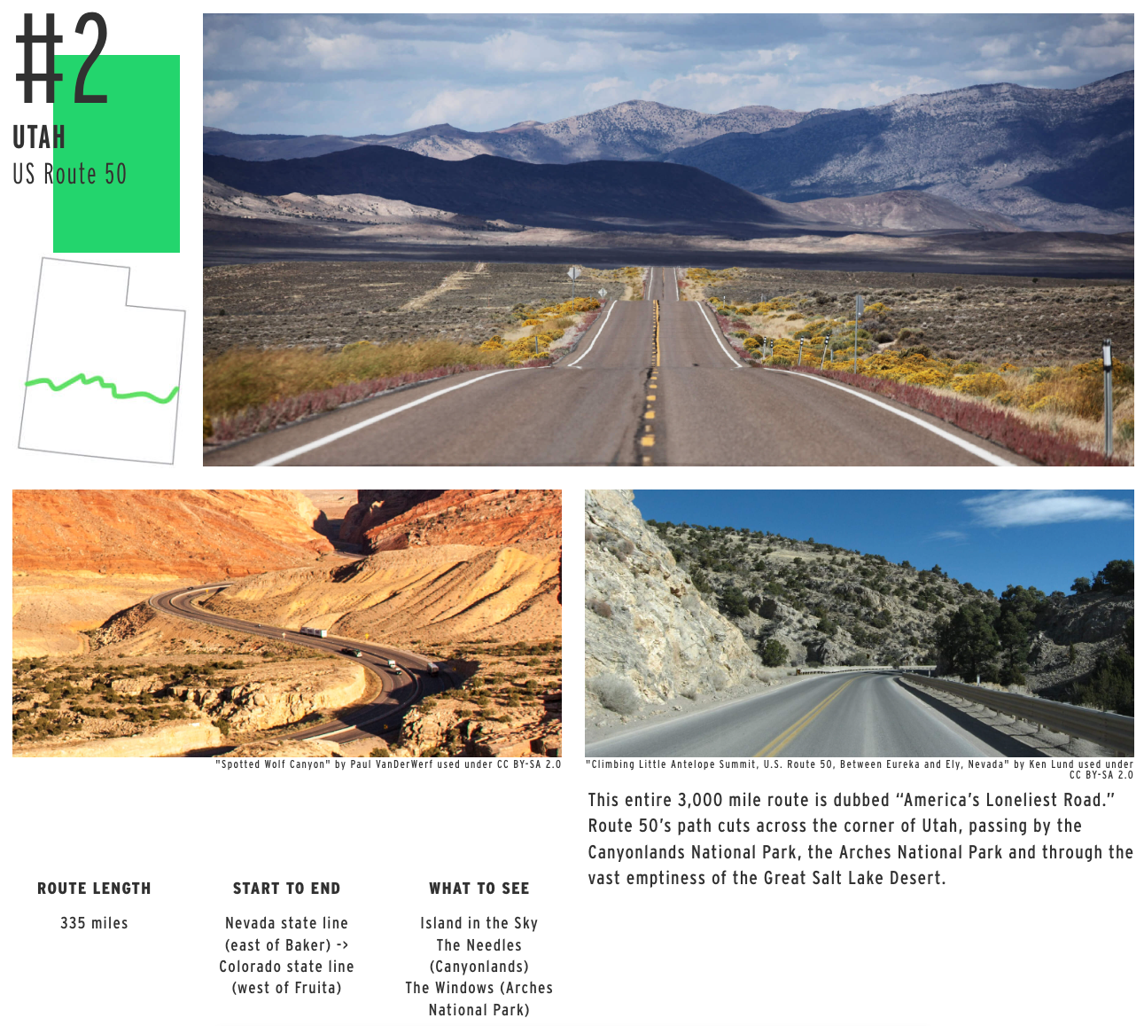
Geotab asked landscape photographer James Q. Martin to pick the ten most scenic routes from America’s 50 loneliest ones. The Dalton Highway, with its sweeping views of mountain wilderness (and the occasional polar bear), again came out on top. Utah’s loneliest road got second place, with third place going to U.S. Route 201 in Maine. (For the complete ranking, check this page at Geotab).
Below are the 45 remaining loneliest roads in America. (Geotab doesn’t provide their AADT, so they’re listed alphabetically.)
- Alabama: State Route 5 (198 miles, from Thomasville to Natural Bridge)
- Arizona: U.S. Route 160 (256 miles, from Tuba City to Teec Nos Pos, on the New Mexico state line)
- Arkansas: U.S. Route 165 (183 miles, from Ashley County to North Little Rock)
- California: State Route 139 (143 miles, from Susanville to the Oregon state line)
- Colorado: U.S. Route 385 (318 miles, from the Oklahoma state line in Baca County to the Nebraska state line in Sedgwick County)
- Connecticut: State Route 83 (63 miles, from Glastonbury to Springfield, on the Massachusetts state line)
- Delaware: State Route 18 (19 miles, from Federalsburg, on the Maryland state line, to George Town)
- Florida: State Route 29 (76 miles, from Carnestown to Palmdale)
- Georgia: State Route 24 (222 miles, from Statesboro to Watkinsville)
- Hawaii: State route 19 (100 miles, from Hilo to Kailua-Kona)
- Idaho: U.S. Route 89 (44 miles, from Bear Lake to Geneva, on the Wyoming state line)
- Illinois: State Route 96 (141 miles, from Kampsville to Lomax)
- Indiana: State Route 145 (45 miles, from Tell City to French Lick)
- Iowa: State Route 4 (146 miles, from Panora to the Minnesota state line, near Estherville)
- Kansas: State Route 383 (74 miles, from Selden to Woodruff, on the Nebraska state line)
- Kentucky: State Route 10 (118 miles, from Alexandria to Greenup)
- Louisiana: U.S. Route 65 (101 miles, from Clayton to the Arkansas state line, near Gassoway)
- Maine: U.S. Route 201 (157 miles, from Brunswick to Sandy Bay, on the Canadian border)
- Maryland: U.S. Route 219 (48 miles, from Red House, on the West Virginia state line, to Grantsville, on the Pennsylvania state line)
- Massachusetts: State Route 32 (61 miles, from Monson, on the Connecticut state line, to Royalston, on the New Hampshire state line)
- Michigan: U.S. Route 45 (55 miles, from Watersmeet to Lake Superior)
- Minnesota: State Route 32 (145 miles, from Tansem Township to Greenbush)
- Mississippi: State Route 57 (91 miles, from McLain to Gautier)
- Missouri: U.S. Route 136 (**; 240 miles, from Alexandria to Brownsville, on the Nebraska state line)
- Nebraska: State Route 71 (170 miles, from the Colorado (***) state line in Kimball County to Crawford, on the South Dakota state line)
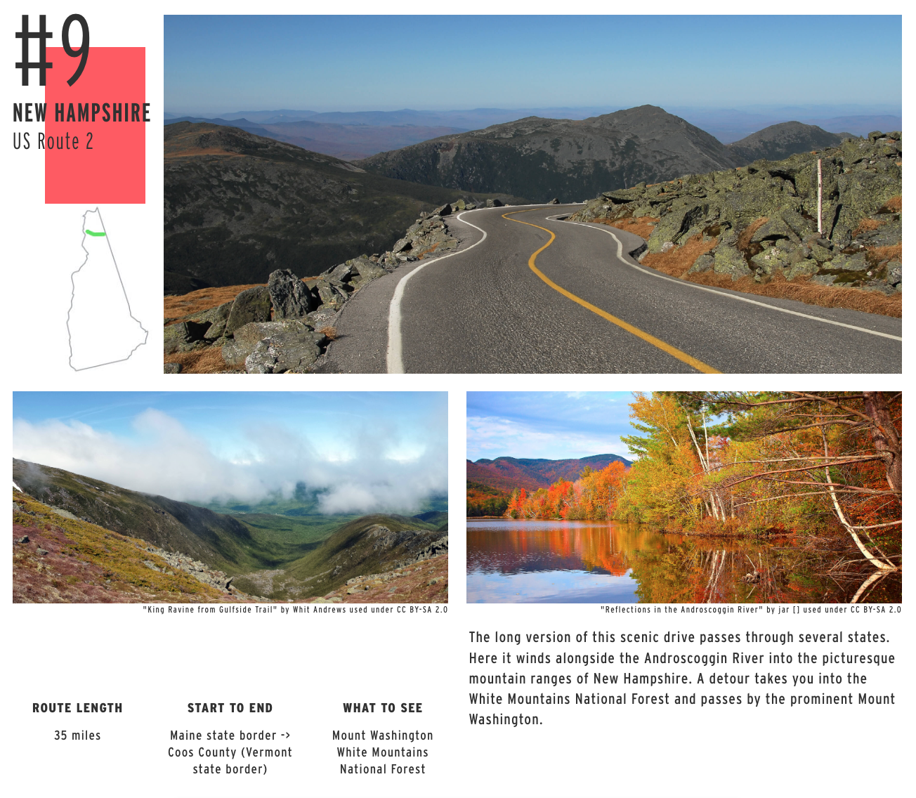
- New Hampshire: U.S. Route 2 (35 miles, from Lancaster, on the Vermont state border to the Maine state border, near Shelburne)
- New Jersey: State Route 49 (54 miles, from Pennsville Township to Upper Township)
- New Mexico: U.S. Route 56 (94 miles, from Springer to Clayton, on the Oklahoma state line)
- New York: State Route 812 (81 miles, from Lowville to Ogdensburg, on the Canadian border)
- North Carolina: State Route 172 (39 miles, from Folkstone to Starling)
- Ohio: State Route 571 (50 miles, from Union City, on the Indiana state line, to Bethel Township)
- Oklahoma: U.S. Route 287 (41 miles, from the Texas state line to the Colorado state line in Cimarron County)
- Oregon: U.S. Route 395 (385 miles, from New Pine Creek to the Columbia River, on the Washington state line)
- Pennsylvania: State Route 32 (41 miles, from Falls Township to Kintnersville)
- Rhode Island: State Route 102 (44 miles, from Wickford to Slatersville)
- South Carolina: U.S. Route 321 (271 miles, from Hardeeville to Bowling Green, on the North Carolina state line)
- Tennessee: State Route 104 (114 miles, from Milan to Saltillo)
- Texas: State Route 49 (61 miles, from Mount Pleasant to the Louisiana state line, near Trees)
- Utah: U.S. Route 50 (335 miles, from the Nevada state line, near Baker, to the Colorado state line, near Fruita)
- Vermont: State Route 103 (42 miles, from Rockingham to Clarendon)
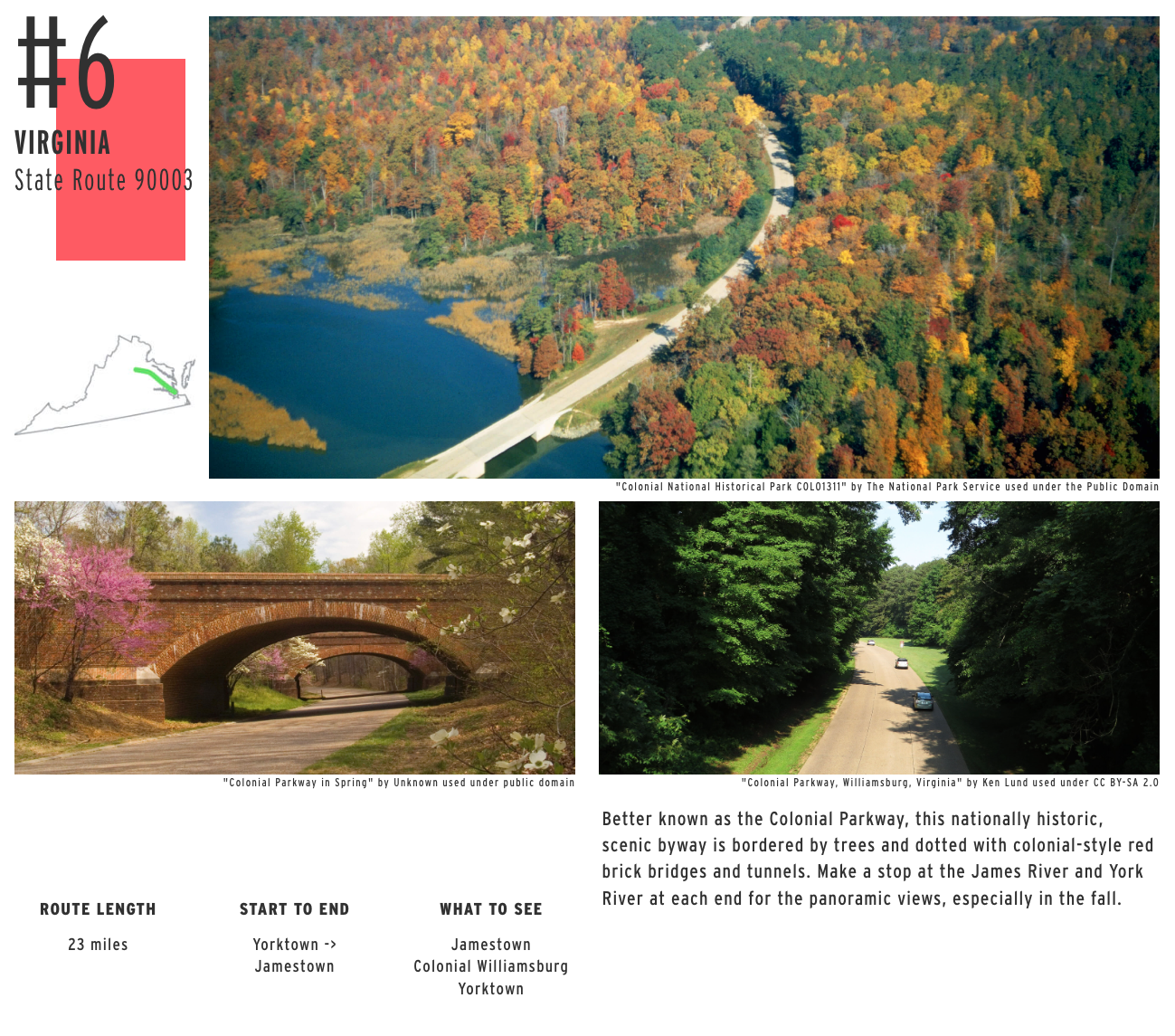
- Virginia: State Route 90003 (23 miles, from Yorktown to Jamestown)
- Washington: State Route 127 (27 miles, from Garfield County to Dusty)
- West Virginia: State Route 93 (33 miles, from Davis to Mineral County)
- Wisconsin: State Route 80 (163 miles, from Hazel Green to Marshfield)
- Wyoming: U.S. Route 212 (35 miles, on the Montana/Wyoming border)
Strange Maps #1157
Got a strange map? Let me know at strangemaps@gmail.com.
Follow Strange Maps on Twitter and Facebook.
*: and not from Los Angeles via Long Beach to Santa Ana, as previously stated. Thanks, Aaron!
**: and not Route 137, as previously mentioned. “Being an east-west U.S. highway, one would expect it to be even-numbered”, Eric Tankesley-Clarke rightly mentions. Thanks, Eric!
***: and not the Kansas state line, as previously mentioned. Thanks to Klint Stewart for pointing this out! Incidentally, the road is shown in the wrong place on the map; it should be further west, where it can actually connect South Dakota to Colorado.