Skip to content
Guest Thinkers

Volcano Profile: Mt. Hood

Everything you ever wanted to know about Mt. Hood in Oregon (well, maybe not everything, but a lot), the second in my “Volcano Profiles” series.

Back in the days when Eruptions was on WordPress, I held a vote about what volcano should be the next to be profiled on this blog. The winner was Mt. Hood in Oregon, and after much waiting, the profile is here. I will actually be out of town until Monday doing some house shopping in this little town. Enjoy this look at one of the most picturesque (and hazardous – #4 in fact) volcanoes in the lower 48 states.


VOLCANO PROFILE: MT. HOOD
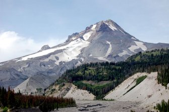

Mt. Hood, Oregon in August 2008 taken by Erik Klemetti.

  • Location: Oregon, U.S.A.
  • Height: 3,426 m / 11,240 ft
  • Geophysical location: Along the Cascade arc where the Juan de Fuca plate subducts under the North American plate. The next potentially volcanoes to the north are Mt. Adams and Mt. Saint Helens (they lie at roughly the same latitude) and the potentially next volcano to the south is Mt. Jefferson. (see below)

  • Active Cascade volcanoes. Image courtesy of the USGS.
  • Type: Composite volcano
  • Monitoring: Cascade Volcano Observatory (whose main office is a stone’s throw away from Hood in Vancouver, WA)
  • Summary: Mt. Hood is one of the most recently active Cascade volcanoes, and also one of the closest to a major U.S. city. Portland, Oregon lies only 75 km / 46 miles to the west of the edifice and the Columbia River – a major shipping and power generating river – is 40 km / 25 miles the north. The volcano has erupted basaltic andesite through dacite in the form of lava flows, domes and pyroclastic eruptions over the last 730,000 years, but ancestral volcanoes in that location can be traced back millions of years. The volcano is also host to 12 glaciers and its pre-European activity can be seen in the legends of Wy’east. The volcano has also had a number of debris avalanches and mudflows – some not directly related to volcanism – that have reached as far as across the Columbia River and wiped out the bridge on Highway 35 near Government Camp as recently as 2006.
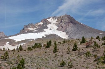
  • Current status: Mt. Hood is not believed to have significantly erupted since the Old Maid eruptive period that ended just before the turn of the 19th century. Lewis & Clark in 1804-05 famously found great quantities of debris in the river channels leading away from the volcano (giving one of them the name “Sandy River” because of the sediment) and into the Columbia River. This eruptive period built the Crater Rock dome that can be seen from Timberline Lodge on the volcano (see below). Minor eruptions were claimed to be witnessed by residents of Portland during the 1800s and one VEI 2 explosive eruption occured in 1859. There was an earthquake swarm centered underneath Mt. Hood in 1980, but no eruption or increased signs of eruption followed.

  • Mt. Hood taken near Timberline Lodge showing Crater Rock in the avalanche scar. Taken by Erik Klemetti in August 2008.
    • Notable Recent Eruptions and History: As noted above, the most recent significant eruption was the “Old Maid” episode that created the Crater Rock dome and sent pyroclastic flows (mostly in the form of dome-collapse block & ash flows) and lahars down the SW side of the volcano towards Troutdale. The Old Maid period erupted ~0.15 km3 of dacite lava. Prior to the Old Maid period, the Timberline eruptive period ran from ~1,400 to 1,800 years ago and produced at much as 1.1 km3 of erupted material, mostly in the form of pyroclastic flows and debris flows. Again, the eruptions were on the SW side of the volcanic edifice, sending flows down the drainages on that side as far as 80 km / 50 miles downriver. Hood may have been relatively quiet between the Timberline and Pollalie (12-15,000 years ago) during the end of the last Glacial Maximum. There are also some satellite eruptions that occurred near Mt. Hood, including the Parkdale Flow (below), a basaltic andesite lava flow, that erupted ~7,700 years ago.

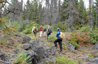
    • The 7,700 year-old Parkdale Lava flow near Mt. Hood being inspected by Dr. Adam Kent, Dr. Kari Cooper and associated graduate students (Gary Eppich, Mark Stelten and Alison Koleszar) in August 2008. Photo by Erik Klemetti.

    • Mitigation:The USGS has prepared an excellent volcano hazard map (below) for the eventual next eruption of Mt. Hood. There are three major threats: (1) lahars and debris flows traveling down the Sandy, White and Hood Rivers; (2) debris from the flows could reach the Columbia River, causing problems with power generation at the Bonneville Dam and; (3) ash disrupting air travel in and out of Portland (and to a lesser degree Seattle) International Airport – anyone who has flow into Portland knows the planes fly right next to the summit of the volcano. Other hazards include pyroclastic flows and volcanic bombs (along with lahars) for Timberline Lodge, Government Camp and other settlements/ski lodges on the edifice itself, travel along Highway 35 could be severely (if not permanently) crippled.
    • Volcanic hazards for Mt. Hood, Oregon. Image courtesy of the USGS


      Related

      Up Next