
Long before the grid plan of New York City’ s island of Manhattan, ancient Olmecs and Mayans were already constructing their own urban centers using a grid system. Structures in these settlements were carefully arranged but not to facilitate transport or trade. Instead, researchers have long suspected that these ancient urban planners made their decisions based on religion above all else.
Studying spatial configurations of early Olmec and Mayan cities can help us understand how their respective civilizations operated. Unfortunately, the study of these configurations has proven difficult. While many pieces of ancient architecture managed to survive into the present day, hardly any city was preserved in its entirety. Since spatial configuration is predicated not on the characteristics of individual buildings but their relationship to one another, researchers often need to acquire every separate piece before they can start assembling the puzzle.
Using lidar (laser imaging, detection, and ranging) technology, an interdisciplinary team of researchers led by University of Arizona anthropology professor Takeshi Inomata managed to identify as many 478 geometric complexes scattered across the Olmec region and Maya lowlands. Together, these pieces of long-lost architecture offer a window into Olmec and Mayan societies, enabling us to see how their cultures spread across Mesoamerica.
The oldest Olmec city
The Olmecs are the earliest known civilization of Mesoamerica, populating the Isthmian region of southern Mexico and western Guatemala between 2500 and 400 BC. They were succeeded by the Mayans, who settled in the same stretch of land somewhere around 350 BC and stayed there until mysteriously disappearing in the tenth century, several hundreds of years before the Spanish conquistadors would set foot on the continent.
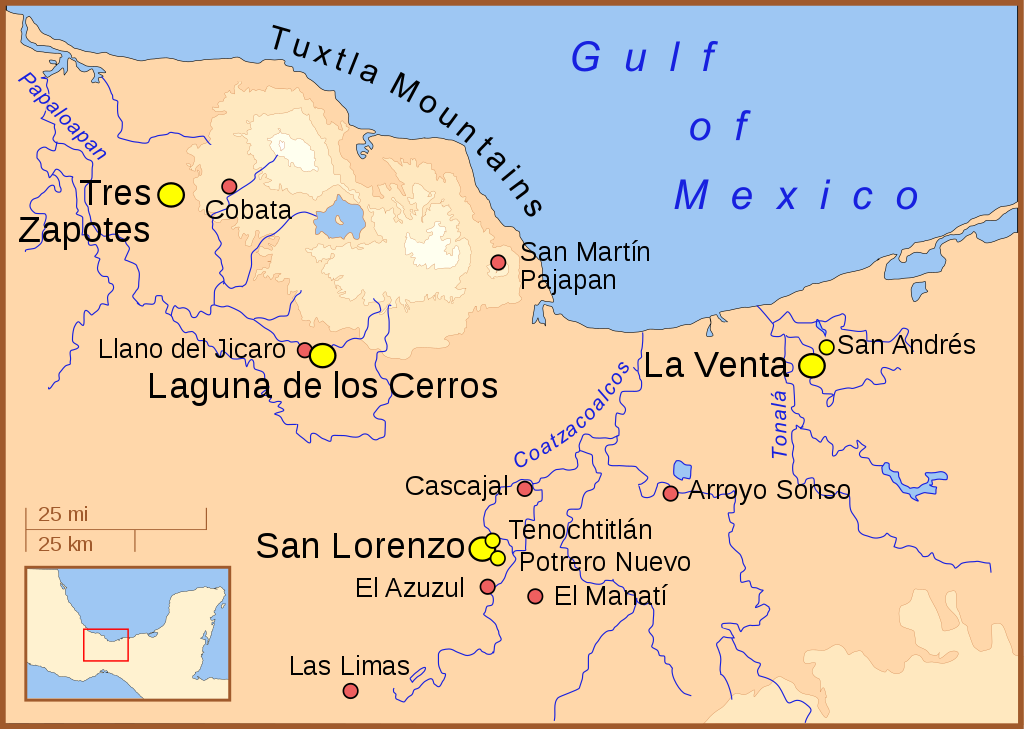
Comparing the spatial configuration of temple complexes from different regions and time periods gives us an impression of the cultural debt that Mayan society owed to its Olmec predecessors. But while several scholars trace the origins of sculptural and ceramic styles back to the Olmec city of San Lorenzo, the influence this site may have had on the development of spatial configurations in subsequent Mesoamerican settlements remains up for debate.
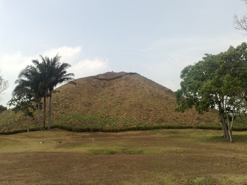
San Lorenzo is the oldest known Olmec site that hints at the existence of a society that reached state-level complexity, and it consists of a large, flat plateau. Though the Olmecs were known to build pyramids, none seem to have been present at San Lorenzo during the city’s zenith. In a 1980 study, an American archaeologist named Michael Coe suggested the plateau had been shaped deliberately to like a bird. Others argued this resemblance was merely accidental and the result of erosion over time.
The emergence of Mayan urban planning
Despite being the oldest Olmec complex ever discovered, the planning of San Lorenzo appeared to have little to no influence on the standardized formats that characterize later complexes. In an attempt to answer questions raised by the ruins of the once great city, Inomata’s Middle Usumacinta Archaeological Project (MUAP) indexed both Olmec and Mayan complexes scattered across an area of 84,516 square kilometers. In the process, his team quickly noticed an architectural pattern connecting these complexes.
MUAP got underway in 2017 near Tabasco, where researchers uncovered a Mayan plateau in the shape of a rectangle. It was 1,413 meters long, 399 meters wide, and between 10 to 15 meters high. The monument, one of if not the oldest of its kind, may have served as a blueprint for similar structures. “The presence of this previously unrecognized pattern,” reads the study, “implies the emergence of standardized ceremonial complexes in southern Mesoamerica was more complex than previously thought.”
Spatial configurations of these complexes were provided by the Instituto Nacional de Estadística y Geografía, which used lidar technology. Though costly, this method has proven rather useful for the study of monuments in remote locations, where thick vegetation makes it hard to get a good aerial view. Conversely, older and much less accurate ground analyses of these sites failed to pick up on structural similarities that had been there all along.
Cosmological architecture
Aside from their main rectangular plateaus, a number of Olmec and Mayan complexes — including those found at San Lorenzo, Aguada Fénix, Buenavista, El Macabil and Pajonal — also appear to consist of 20 smaller, adjacent plateaus, which the researchers refer to as “edge platforms.” They suggest this construction may have been derived from the Mesoamerican calendar, which was organized not in groups of seven days but 20.
Some of the complexes also appear to have been positioned in accordance with the solar zenith, their directional symbolism hinting at the “forms of ritual processions that were carried out there.” Other complexes, particularly those located in mountainous regions, may have been aligned with peaks and volcanoes instead. “These patterns,” the study goes on, indicate that builders “designed their ritual spaces by selectively using various cosmological principles and adjusting them to local conditions.”
Last but not least, Inomata’s findings also recontextualize the cultural significance of San Lorenzo’s ruins, whose flat, rectangular blueprint actually bears a much greater resemblance to other complexes than had been initially expected. This standardized format, concludes the study, “was probably formalized and spread after the decline of San Lorenzo through intensive interaction across various regions. These observations highlight the legacy of San Lorenzo and the critical role of intergenerational interaction.”