If the ancient Romans had Google Maps
- Like us, the Romans were adept at scrolling — except they used actual, unwieldy scrolls.
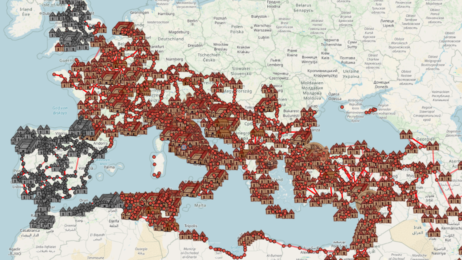
- They would have loved OmnesViae, a handy online route planner, just for Roman roads.
- Handy, yes. But crossing the empire would still be a schlep of more than 250 days.
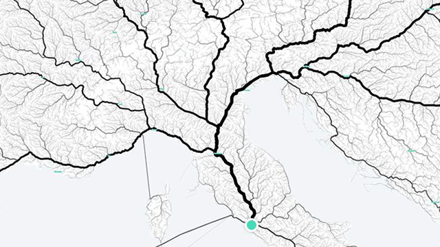
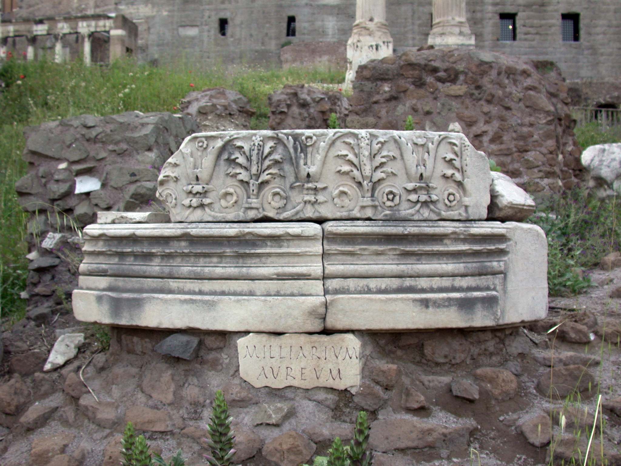
In 20 BC, the emperor Augustus had a giant gilded spike installed next to the Temple of Saturn on the Forum Romanum. This was the Milliarium Aureum, or Golden Milestone, from which distances to cities throughout the empire were measured — and the true subject of the saying: omnes viae Romam ducunt (“all roads lead to Rome”).
It was a boast with more than a little truth to it. The Roman Empire’s extensive network of well-engineered, preferably straight roads was one of its main unifying features, a fact Augustus himself was very aware of. He put considerable effort into his reform of the road administration, had several roads built out of his own pocket, and created a courier service to optimize the usefulness of the network. Not for nothing did his litany of honorifics include the title Curator Viarum (“Steward of the Roads”).
Rome’s roads really tied the empire together
In its heyday, Rome’s cursus publicus (“public road network”) consisted of about 380 interconnected roads, totaling around 50,000 miles (app. 80,000 km). Way stations and milestones facilitated the movement of traders and soldiers. In other words, they were vectors for the extension of Rome’s wealth and power. And they really did tie the empire together. Find yourself anywhere on the network, from the frozen wastes of northern Britannia to the shores of the Persian Gulf, and you easily could find your way back to Rome.
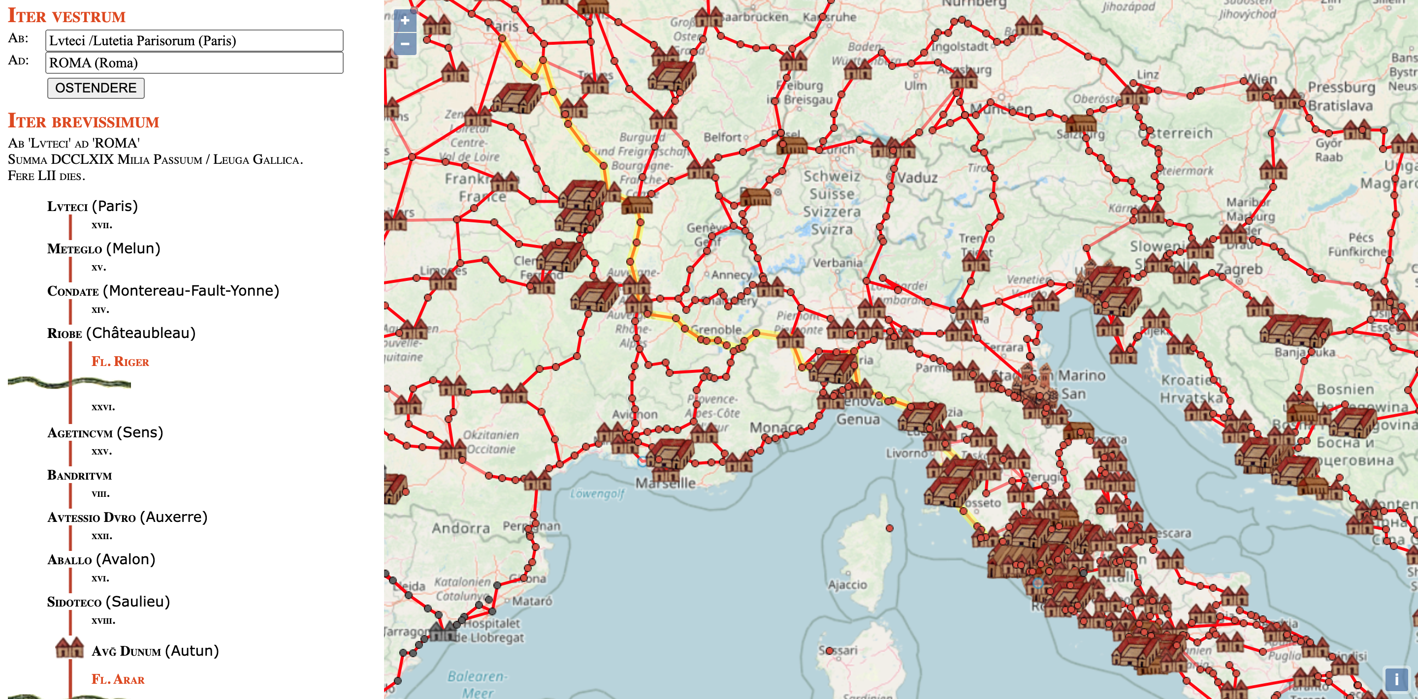
Easily perhaps, but not necessarily quickly. Lacking motorized transport, Romans could travel only as fast as legs could carry them — their own, or if they could afford them, those of their horses. Unfortunately, ancient Rome also lacked a decent internet connection, otherwise travelers could have looked up the course and duration of their trip on OmnesViae.com, the online route planner the Romans never knew they needed.
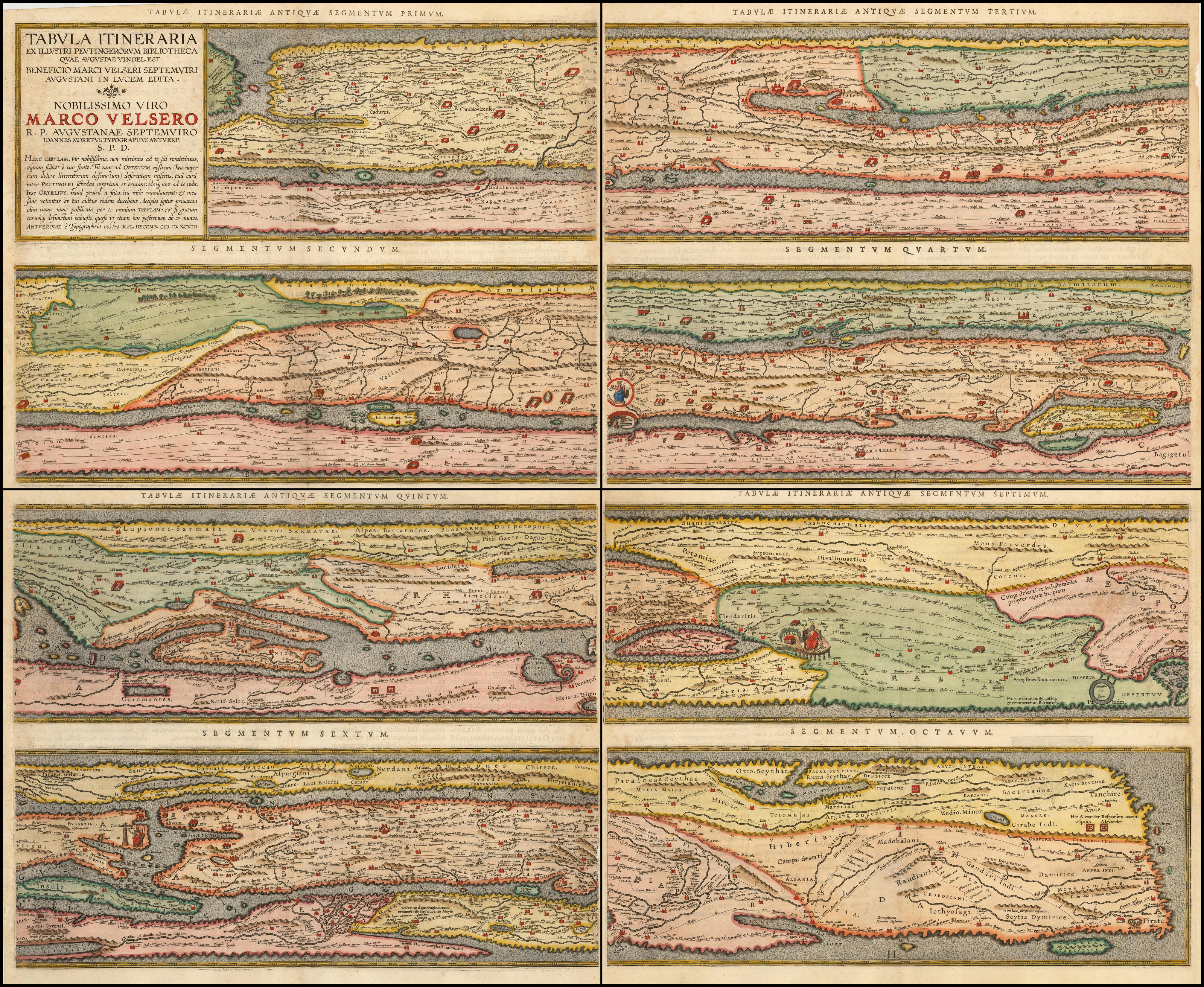
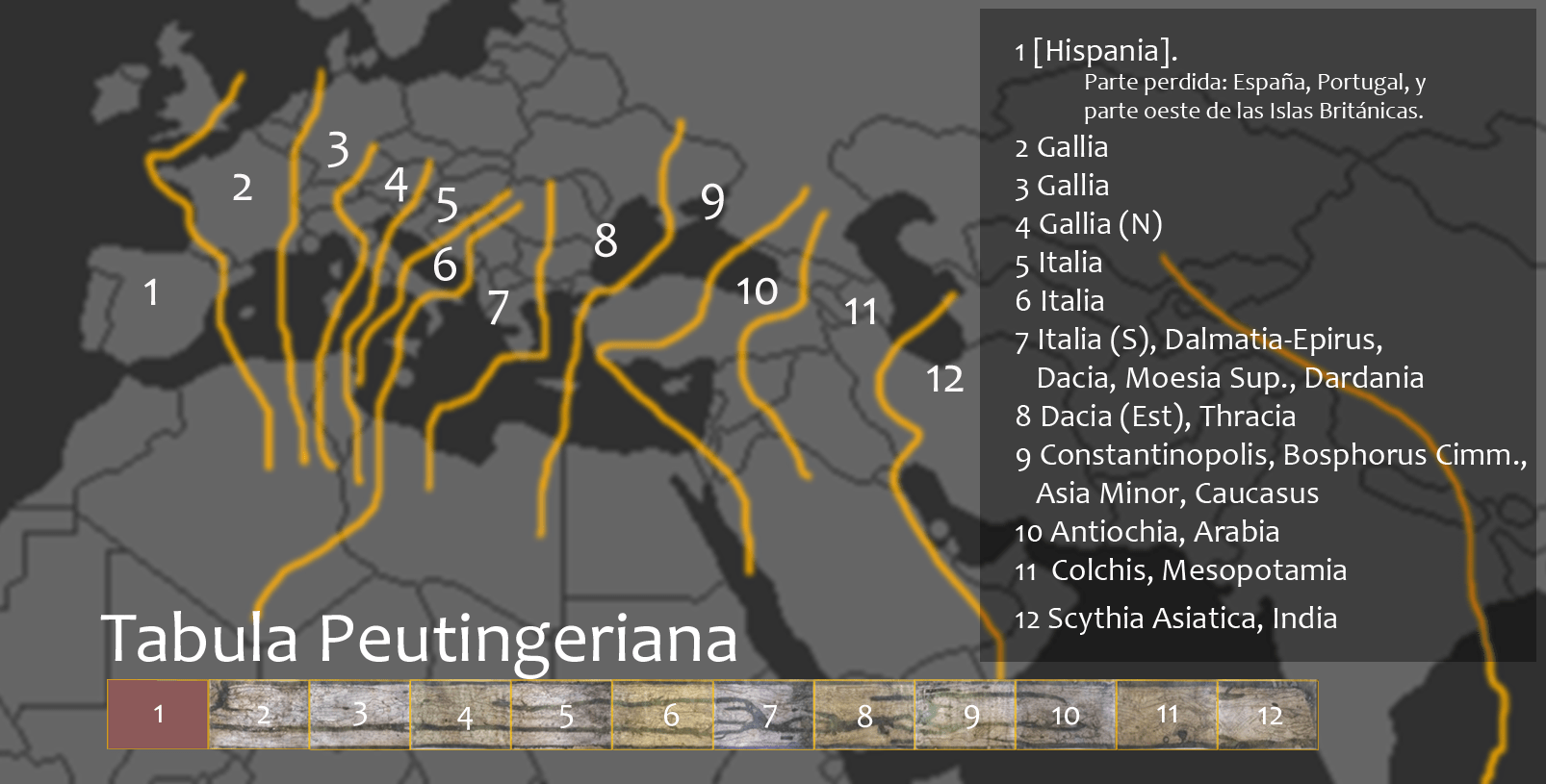
OmnesViae leans heavily on the Tabula Peutingeriana, the closest thing we have to a genuine itinerarium (“road map”) of the Roman Empire. Ancient Rome certainly had maps, but none from that time survive. The Peutinger Map, a 13th-century parchment scroll, is a copy of a much older map, which is only two “possibles” away from the Steward of the Roads himself: It may date from the 4th or 5th century, and that version may be a copy of a map prepared for Augustus around year 1 AD.
One argument in favor of the Augustan link: the map includes ancient Pompeii, which was destroyed by an eruption of Mount Vesuvius in 79 AD and never rebuilt, which points to an earlier origin. (Modern Pompei was founded only in 1891.) Yet it also includes Constantinople and prominently features Ravenna, which suggest the map copied by that anonymous 13th-century monk was an updated version from the 4th century (at the earliest), or more likely the 5th, as it splashes the name Francia (France) — after the newly arrived Germanic tribe of the Franks — across what until then was known exclusively as Gallia (Gaul).
Roman maps were just like… Tube maps?
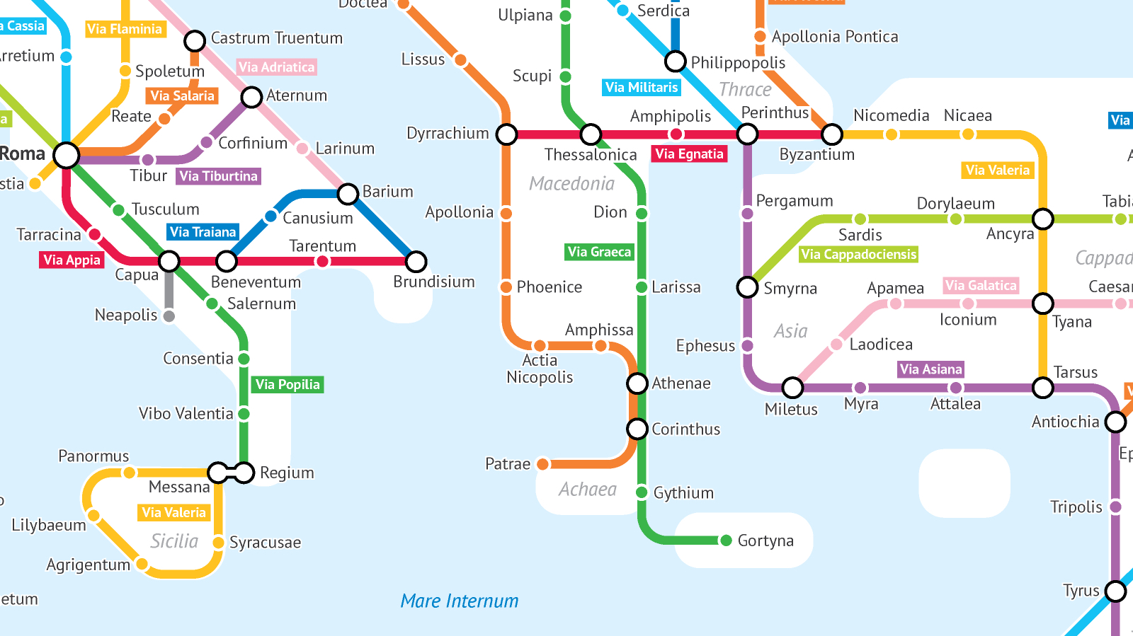
Whatever its ultimate age, the shape of the Tabula — about a foot high and 22 feet long (33 cm by 6.75 m) — tells us that it cannot be topographically accurate. Instead, it focuses on presenting road corridors and connectors, with a few branches forking off through Persia all the way to India. By sacrificing topographic accuracy for network connectivity, the Peutinger Map is strangely reminiscent (or should that be “predictive”) of the London Tube map and other modern metro maps.
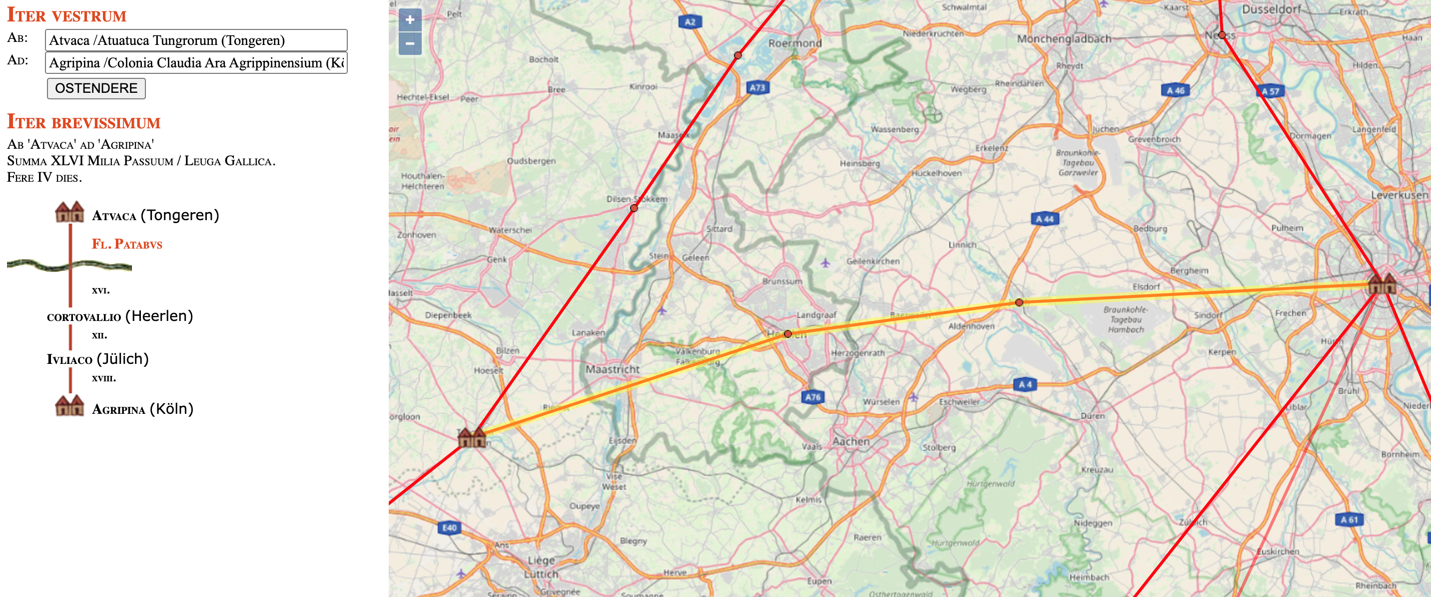
Geolocating thousands of points from Peutinger, OmnesViae reformats the roads and destinations on the scroll onto a more familiarly landscaped map. The shortest route between two (ancient) points is calculated using the distances travelled over Roman rather than modern roads, also taking into account the rivers and mountains the network must cross.
The Peutinger, for all its historical value, is not complete: It misses Britain and Spain. The roads of those Roman provinces were reconstructed using other sources, including the Itinerarium Antonini, a register (rather than a map) of Roman roads, way stations, and distances, possibly based on an empire-wide survey carried out in the time of Augustus.
Goodbye, Flour Sacks!
So, what’s the farthest distance you could travel on Roman roads? From Blatobulgium to Volocesia must come pretty close.
Blatobulgium was a Roman fort in what is now Dumfriesshire, Scotland, at the northern terminus of Route 2 in the Antonine Itinerary (also known as Watling Street). The fort’s name, Brittonic in origin, may mean something like “Flour Sacks” — a reference to the place’s granaries. It was occupied for about a century following 79 AD.
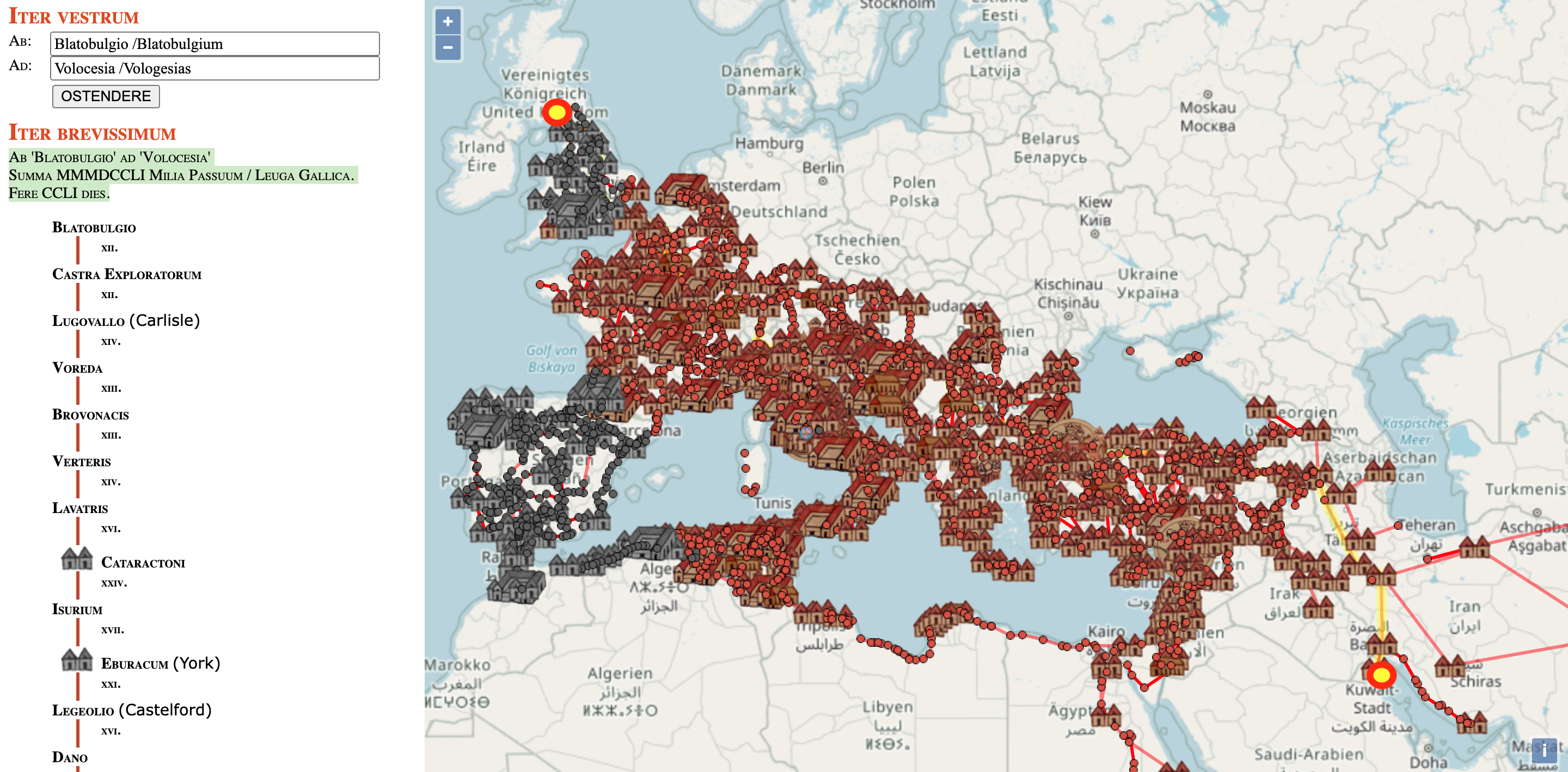
Volocesia, placed by OmnesViae near the Kuwaiti island of Bubiyan, is sometimes identified with a modern place called Abu Halafiya, on the banks of the Tigris in southern Iraq. According to OmnesViae, the distance between both is MMMDCCLI (3,751) Roman miles (about 4,100 modern miles, or slightly more than 5600 km). That trip would take you CCLI (251) days to complete.
That’s not a road trip to undertake casually, but a life-altering (and possibly life-ending) journey. Come to think of it, the same could very well be said today of a walk (or even a ride on horseback) from Scotland to Kuwait — and that’s with Google Maps.
Strange Maps #1150
Got a strange map? Let me know at strangemaps@gmail.com.
Follow Strange Maps on Twitter and Facebook.
