
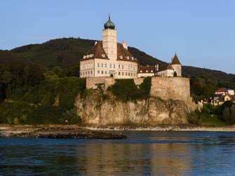
Picture-perfect: Schloss Schönbühel. But there’s more to Austria than just being pretty. Image: Uaoei1, CC BY-SA 4.0
Unless you’re into skiing, double monarchies or “The Sound of Music,” you probably don’t give Austria much thought. Yet everybody’s second-favorite Alpine republic is a locus of many weird and wonderful facts.
If you don’t believe us, check out these infographics produced by @austrianmaps. Here are ten things you’ll now never again be able to un-know about Austria.

Image: Austrian Maps
Austria is far from anywhere. Or, comfortably in the middle of everywhere. Which of these two truths rings truer depends on the elasticity of your travel wants (or needs). As this map shows, the Austrian capital Vienna (that’s that circular thingy in the top right-hand corner) is almost perfectly equidistant between the two megacities book-ending Europe in the northwest and southeast.
Other maps show Austria just as snugly halfway between Madrid and Moscow (if you’re into city trips); and Ibiza and Crimea (if you’re more of a beach person).

Image: Austrian Maps
In its mission statement on Twitter, Austrian Maps promises “maps of Austria from moderately interesting to plain terrible.” In order to set the bar at the appropriate height, we get Austria’s version of the ‘Indiana/Outdiana‘ map.
Don’t let this put you off, though: Innsbruck is a lovely city (go check out the Golden Roof, completed in 1500) and close to the Alps (take the funicular Hungerburgbahn from the city centre straight up into the mountains).

Image: Austrian Maps
A few centuries ago, which side of the road you drove on was political. That’s because Napoleon, the great equaliser, introduced right-hand traffic wherever he went. Which may explain why his arch enemies, the Brits, so obstinately clung to the other side of the road. The Austrians weren’t too keen on him either, so when he left, they went back to… chaos: right-hand traffic here, left-hand traffic there.
- In 1915, Austria-Hungary generalised left-hand traffic, but protests led to the reintroduction of right-hand traffic in Vorarlberg in 1921. Which was not that much of a bother, because at the time, this state was only connected to the rest of Austria via two mountain passes.
- Following a general pact across Europe in 1927 to go with right-hand traffic, the rest of Austria switched back as well, but not immediately and not all at once, because the states couldn’t agree on a unified timetable.
- On 2 April 1930, the west of the country (up to the city of Lend) switched from left to right. Carinthia and Eastern Tyrol made the switch on 15 July 1935.
- Following Austria’s annexation by Nazi Germany, on 1 July 1938 the German traffic code came into effect, imposing right-hand traffic.
- Except in Vienna and surrounding areas, where left-hand traffic remained in force until 19 September 1938.

Image: Austrian Maps
Jungholz is an Austrian town, but it’s surrounded on all sides by Germany. Does that make it an exclave? It would, if it didn’t touch the rest of Austria at a single point – the summit of Mount Sorgschrofen, where four borderlines meet: two German, two Austrian.
Which means Jungholz is a pene-exclave (i.e. an ‘almost-exclave’, just like a peninsula is an ‘almost-island’). Nevertheless, because it can only be reached via German territory, it is cut off from direct access to the rest of Austria, and thus is a ‘practical exclave’.
Because of this, the town has been economically aligned with its Bavarian (and later German) neighbors, but those differences have been mostly subsumed within the European Union. It still maintains both a German and an Austrian post code, though.

Image: Austrian Maps
If you’re a picturesque enough country, James Bond will come race your city centers to bits, killing any number of Her Majesty’s foes and scaring the locals witless. Austria is a particular favorite – visited by no less than four iterations of secret agent 007:
- George Lazenby (“On Her Majesty’s Secret Service”),
- Roger Moore (“The Spy Who Loved Me”),
- Timothy Dalton (“The Living Daylights”) and
- Daniel Craig (“Spectre,” “A Quantum of Solace”).
And there’s plenty more places to blow up in Austria, the map helpfully suggests. If we were scouting for locations for the next Bond (m/f), the dam at Kaprun and the nuclear plant at Zwentendorf would be on the top of our list, too.

Image: Austrian Maps
Austria may be a proper country with a flag and a president and all the other trappings of modern statehood, but it’s rather keenly aware of its own diminutiveness. That certainly has to do with the fact that it was once the senior partner in a much grander nation: the Austro-Hungarian Empire, one of Europe’s major powers until its demise following World War I.
With a certain masochism (named after Leopold von Sacher-Masoch, an Austrian), this map points out cities around the world – many not even capital cities – that have a larger population than Austria, which has 9 million inhabitants.

Image: Austrian Maps
Austria’s national anthem is the last melody written by Mozart before he died. That was the official story, but it turns out it’s too good to be true: the masonic hymn was probably penned by one of Mozart’s fellow lodgers.
The lyrics, of much later origin, describe Austria as “Land der Berge, Land am Strome, Land der Äcker, Land der Dome” (‘Land of mountains, land by the river Donau, land of fields, land of cathedral domes’).
What does that cover? Quite a lot, as this map shows, but not all of Austria, not by far. But then, “land of bits in between” doesn’t quite have that anthemic ring to it.

Image: Austrian Maps
They’re not quite on any Unesco world heritage list just yet, but Vienna’s balls really should be. If not because they’re a spectacular, centuries-old tradition replete with elaborate dresses, genteel manners and shedloads of classical music, then because they are both completely out of place in the modern world – and a wonderful escape from it.
Each winter season, the Hofburg Palace, Vienna’s Rathaus (City Hall), the Vienna State Opera and other locations across town are filled with so many dancing debutantes and scheming socialites that you may be forgiven to think the Kaiser is still sitting on his throne.
In all, Vienna counts around 400 annual balls, many hosted by professional guilds, like the academic association, the medical profession or even the real estate sector. As the map shows, even some states have their own ball: Upper and Lower Austria, Tyrol, Styria and Vorarlberg, and… Moscow.
Of course, Moscow is not an Austrian state. Although there are plenty of moneyed Muscovites who wouldn’t mind. Not all of Russia’s bling gravitates to London. There’s plenty to go around, and some of it likes to dress up and dance. And when that happens, it’s not that hard to imagine that it’s 1815 again, Vienna is the world’s largest congregation of diplomats (there to hammer out the Treaty of Vienna), and there’s still a Tsar on the throne in Moscow.

Image: Austrian Maps
Q: How much fun can mapmakers have? A: As much as their imagination allows. Case in point: this Easter-themed map (hence the bleating lamb) comparing the egg-shapedness of Austria’s various states.
Vienna is the state most overlapping with an egg of the same size (0.905), Elongated Burgenland (a.k.a. Austria’s Chile) is the least egg-like state (0.521).
And what does this teach us? That it can be fun to follow the data, even if it leads you into a blind alley, where you get robbed of your seriousness. Sometimes, a good laugh is worth taking one on the chin.

Image: Austrian Maps
There are still emperors in Vienna, but they’re all dead and buried. However, just going on the number of burial sites, you could think there are three times as many of the dead blighters as there actually were in real life.
That is because, lugubriously, emperors and other Habsburg royals were traditionally buried in three pieces: their bodies in the Capuchin Crypt, minus their hearts (which went to the Loreto Chapel) and also sans their inner organs (which were preserved – if that’s the right word – at St Stephen’s Cathedral).
All maps reproduced with kind permission. For more Austrian map madness, check out Austrian Maps on Twitter.
Strange Maps #1029
Got a strange map? Let me know at strangemaps@gmail.com.