Strange Maps
A special series by Frank Jacobs.
Frank has been writing about strange maps since 2006, published a book on the subject in 2009 and joined Big Think in 2010. Readers send in new material daily, and he keeps bumping in to cartography that is delightfully obscure, amazingly beautiful, shockingly partisan, and more. "Each map tells a story, but the stories told by your standard atlas for school or reference are limited and literal: they show only the most practical side of the world, its geography and its political divisions. Strange Maps aims to collect and comment on maps that do everything but that - maps that show the world from a different angle."
featured


All Stories

When the invasion comes, head for the mountains. Sorry, flatlanders!
An updated version of the famous United States of Canada vs. Jesusland map (see posting #3 on this blog). That map represented the outcome of the US presidential election in […]
This blog has been up since September 2006. In that half year, I’ve posted 90 maps, gotten about 1.000 comments – most of them interesting and/or favourable – and just […]
n n n n n At the beginning of the twentieth century, the Ottoman Empire was called the ‘Sick Man of Europe’ because it didn’t seem able to hold on to […]
n This recently unclassified, formerly top secret document released by the Russian State Archives illustrates (quite literally) the lengths the Soviets wanted to go to in order to win the Cold War: not […]
n This brilliant map is in a gang of one, for the time being – gastronomic cartography. An intriguing category nonetheless: La France des pains (‘The France of Breads’) visually […]
n Jack Kerouac was born in Lowell (MA) Jean-Louis Lebris de Kerouac, and in spite of his fancy name, his French-Canadian parents had to emigrate to Massachusetts to find work. […]
n n On August 13, 1961, the East German authorities erected a physical barrier in Berlin to prevent their citizens from ‘voting with their’ feet – i.e. fleeing to West […]
n Richard Edes Harrison trained as an architect, but became known as an illustrator for Time (from 1932 onwards) and other national news magazines. His specialty was cartography, applying unusual […]
n … then “Jupiter would be revoking democracy in Russia, Saturn would be curling in Canada, Uranus would be trying to figure out how to speak Kalaallisut, Neptune would be […]
n Not much info on this, the third (*) of former West Berlin’s ten tiny enclaves within former East Germany. This website on Berlin exclaves merely mentions that Laßzinswiesen “was […]

The ‘bloodless’ Aroostook War is variously said to have cost the life of a cow, a pig, or a single U.S. private.
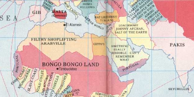
For me, this might be the original strange map. When I was a kid, I had the Spitting Image book that contained this map. I spent hours (well… whole quarters of hours) […]
Your antipodes most likely have fins rather than feet
A tilt in the usual orientation shows Moscow in a much more threatening perspective

This map is drawn up by a proponent of evolution, as can be deduced from the remarks on the map and even its colours (green is good, red is bad).

This map is part of a series of cartograms in which the actual geography is distorted in order to demonstrate information about the countries shown. In this case, the point […]

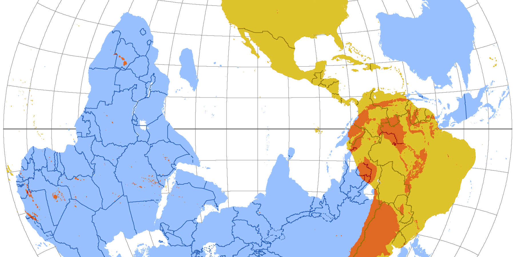
A series of maps detail the rapid disappearance of Lake Chad in Africa.

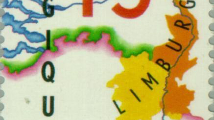
The Treaty of London gave the eastern half to the Netherlands, creating its curious southern panhandle

Ever since it achieved unification in 1871, Germany craved colonies as a matter of national pride. But by the late nineteenth century, most of the ‘uncivilised world’ was already carved […]
n n This map, made by Mahmud Kashgari bin Husayn bin Muhammad, was included in his Divanu Lügat-it-Türk, a scientific work he published in 1072 (AD) for the benefit of […]
n Gulliver’s Travels (1726) is a satire of contemporary England dressed up as a faux traveller’s tale by Jonathan Swift, narrating in the first person the voyages of one Lemuel […]
nn n It seems impossible to find an online map showing all of the European Union’s so-called Euroregions. Why doesn’t the EU showcase these transnational regions, conceived to promote economic […]

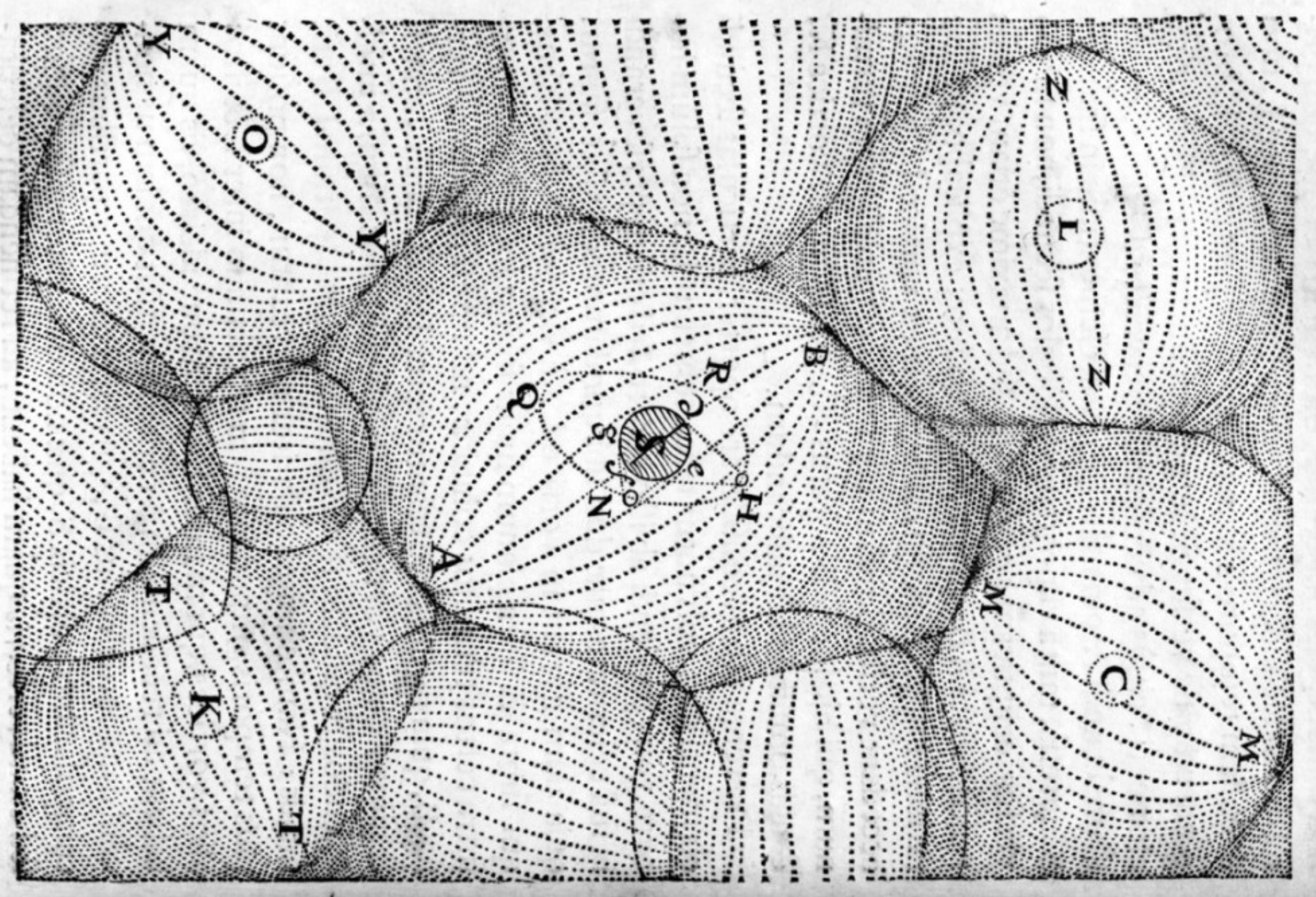
A beautiful map from the time when symbolic cartography was giving way to the Age of Discovery

If the Earth is hollow, where does all that magma spewing out of all those volcanoes come from? Somebody must have a half-convincing answer to that question, presumably that handful […]
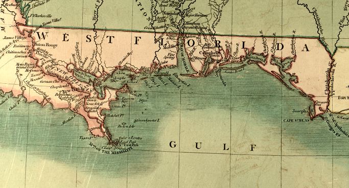
“West Floriday, that lovely nation, Free from king and tyranny, Thru’ the world shall be respected, For her true love of Liberty!” So goes a marching song that never got […]
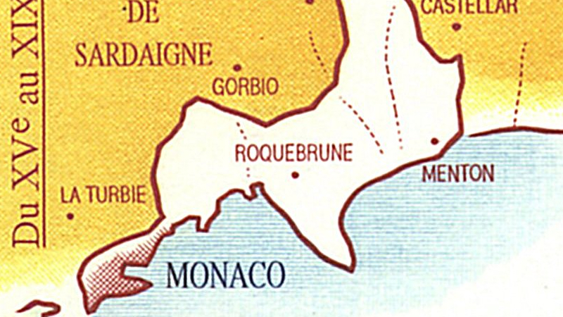
Even one of the world’s most comically small countries can look back on centuries of territorial bigness.
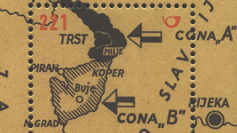
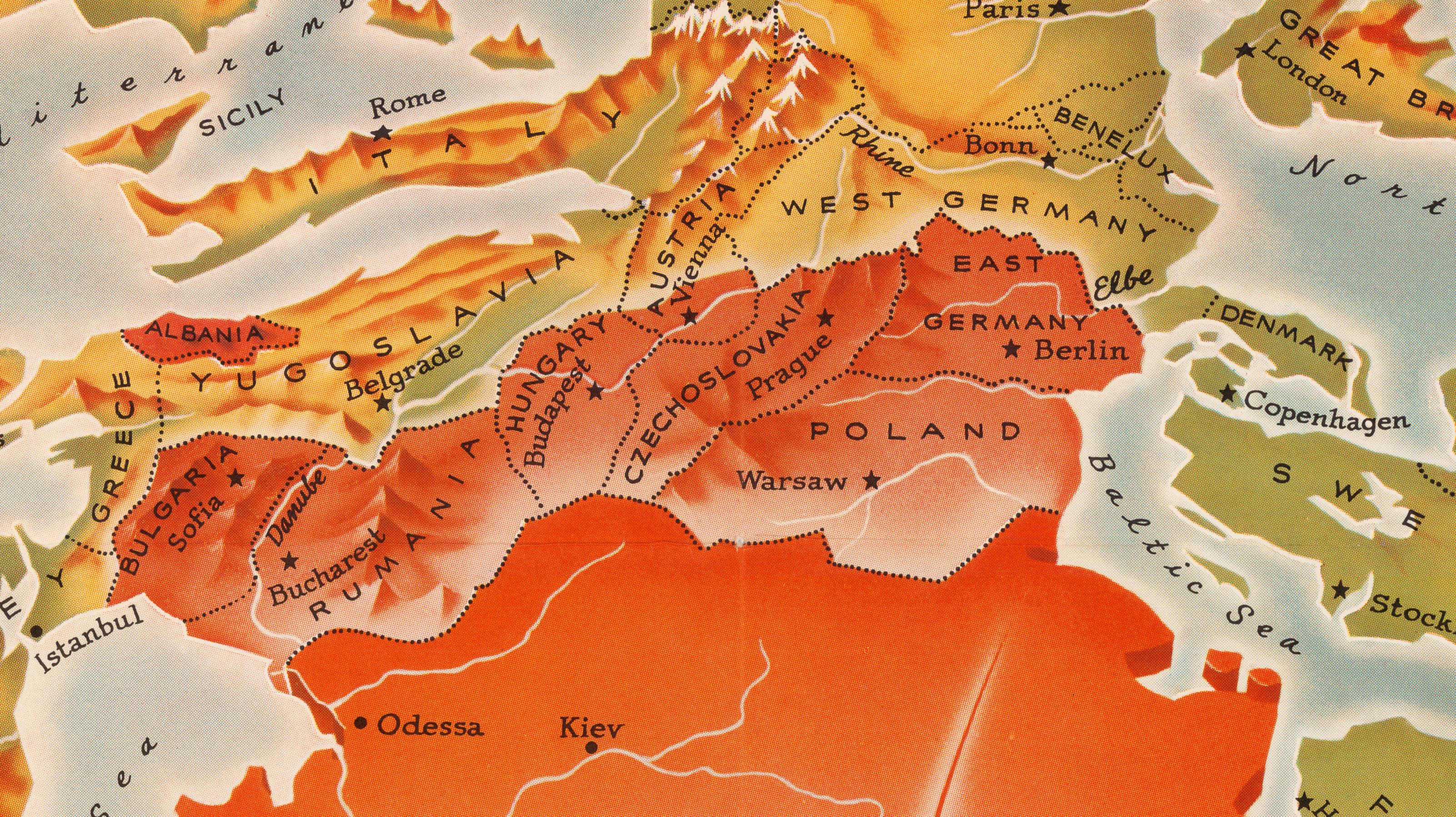
The southern terminus of the Iron Curtain could have been the starting point of World War III
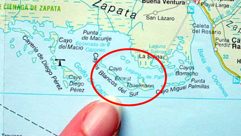
Castro gifted the island to East Germany. They never gave it back. So whose is it now?