Strange Maps
A special series by Frank Jacobs.
Frank has been writing about strange maps since 2006, published a book on the subject in 2009 and joined Big Think in 2010. Readers send in new material daily, and he keeps bumping in to cartography that is delightfully obscure, amazingly beautiful, shockingly partisan, and more. "Each map tells a story, but the stories told by your standard atlas for school or reference are limited and literal: they show only the most practical side of the world, its geography and its political divisions. Strange Maps aims to collect and comment on maps that do everything but that - maps that show the world from a different angle."
featured


All Stories
n Not many people know that the epithet Windy City was bestowed on Chicago not for meteorological but political reasons – apparently, Chicago politicians at one time were known for […]
n Five years have past; five summers, with the lengthnOf five long winters! And again I hearnThese waters, rolling from their mountain-springsnWith a soft inland murmur (…) n So begins […]
n There are three Christmas Islands in the world. One is a small community on mainland Nova Scotia (Canada) named after a nearby island, which is presently called Ghost Island […]
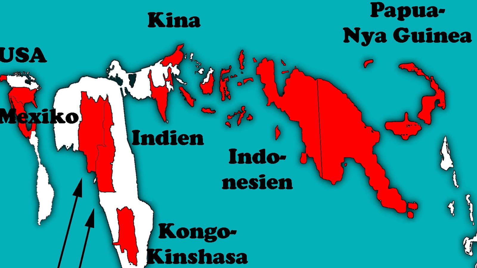
One of the few best-in-class lists topped by PNG
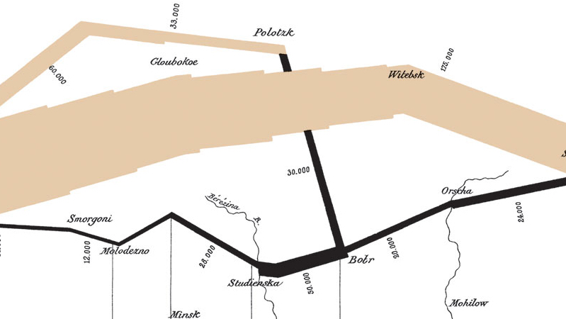
Vital statistics of Napoleon’s deadliest campaign
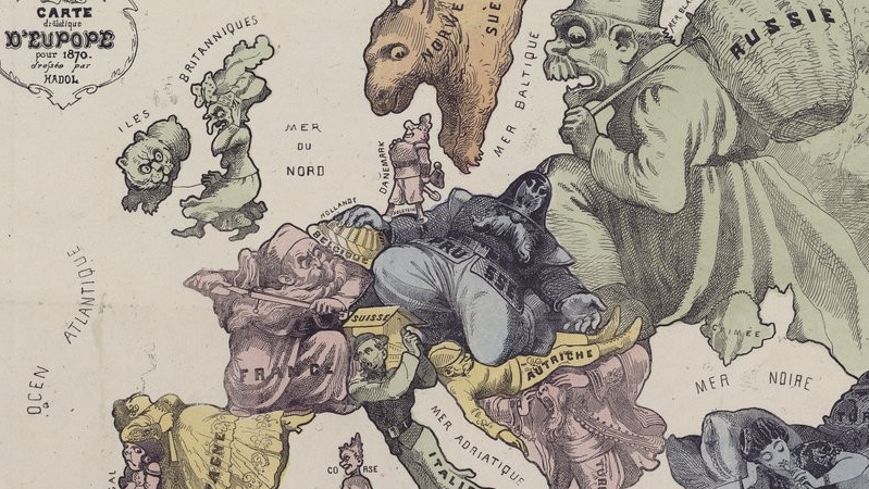
Everybody was getting ready for conflict, but at least they all agreed this map was funny
 n “Geographical manuals in US schools show an amputated Brazil, without the Amazon and the Pantanal. This is how students are taught that these are âinternationalâ areas, in other […]
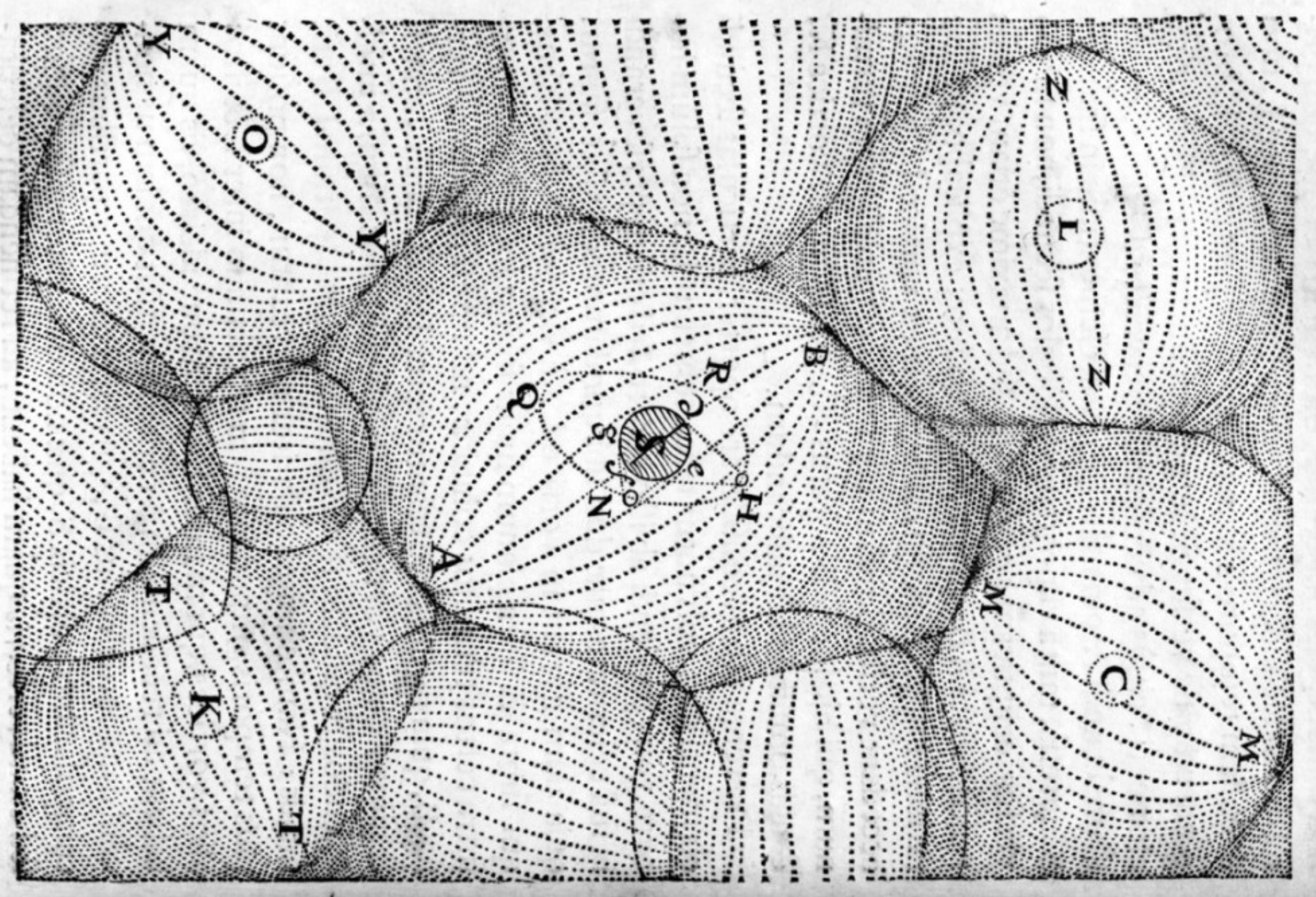
According to Genesis 4:16 (KJV), “Cain went out from the presence of the LORD and dwelt in the land of Nod, on the east of Eden.” According to this map, […]
Lost is not only the title of a popular American tv series, it also describes the exasperated feeling of those viewers looking for a semblance of a plot in the […]
n This is interesting: these cartoons obviously are about the Russo-Japanese War of 1905. But since I’m offline while writing this, I can’t find out much more of the context. […]
Mississippi is the poorest of all states, but fortunately also has a happier distinction: it’s the place where most of the quintessentially American music genres originated, from blues and jazz […]
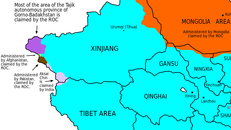
Taiwan – officially: the Republic of China – claims territories of ten of China’s neighbours
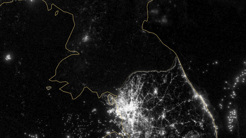
North Korea is the Dark Side of the peninsula, literally.
n n In its issue of 22 April 1996, the New Yorker Magazine published a parody map of Montana, by cartoonist Roz Chast. The state ranks 4th in surface (after Alaska, […]
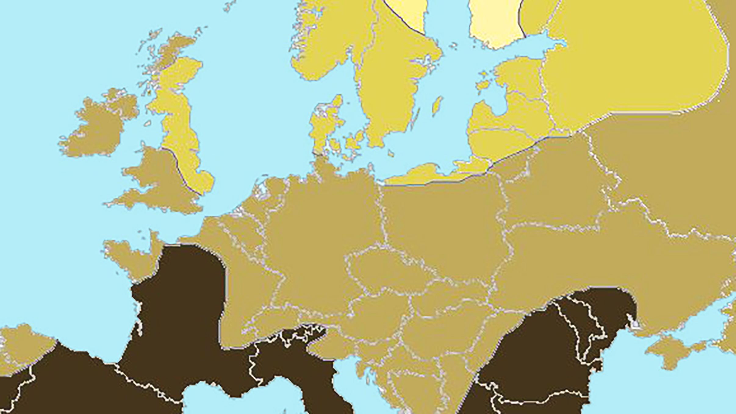
This map, indicating the varying degrees of blondness in Europe, shows how fair hair gets rarer further away from this core area – towards the south, as one intuitively might presume.

“Is this what will become of the Earth’s surface?” asks the entry for 22 September 2007 of Astronomy Picture of the Day, a website affiliated with Nasa (judging from its […]
n The proximity to, the ‘otherness’ of and the seemingly eternal conflict with the barbarian tribes across the Rhine stoked Imperial Rome’s interest in all matters German. To get a […]
n Over 18.000 votes have been cast in a poll to determine once and for all the answer to the burning question: Combien de bises? That’s French for ‘How many […]
n They did a lot of crazy stuff in the Sixties, man. Especially at universities like Berkeley, a hotbed of political radicalism, of experiments with free love and cheap drugs (or […]
Be glad they don’t have coffee-tables in the Tube, métro, subway and U-Bahn, otherwise you wouldn’t have any excuse not to take this book with you on your subterranean peripatations. […]
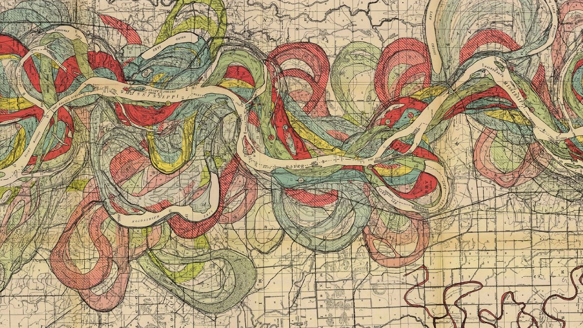
This map beautifully captures the changeable course of the Big River
Hilarious. Found in the Flickr group From Memory (Was: Maps From Memory).
n It’s said that dogs end up looking like their masters. A similar alchemy seems at work between the shape of a country and its results on an economic graph […]
n Gone are the days when just carving three holes in a hollowed-out pumpkin and having a candle project its flickering light from inside would scare the bejeezus out of all […]
n n The Mighty Barrister alerted me to a post on the blog of the Book Design Review by Joseph Sullivan of Chicago, listing his favourite book covers of 2007. […]
“The koality of muh-cy is not strined”: I forget who once pondered the impossibility of believing Shakespeare spoken in an Australian accent. Maybe it’s the implied anachronism, for in Shakespeare’s […]
North America must have the lowest nation/surface ratio in the world. The huge subcontinent is made up of only two sovereign states: Canada and the US (*). This is not […]

If the principle of frontage would be universally applied, so could the U.S., Nigeria, Bangladesh – and even Greenland
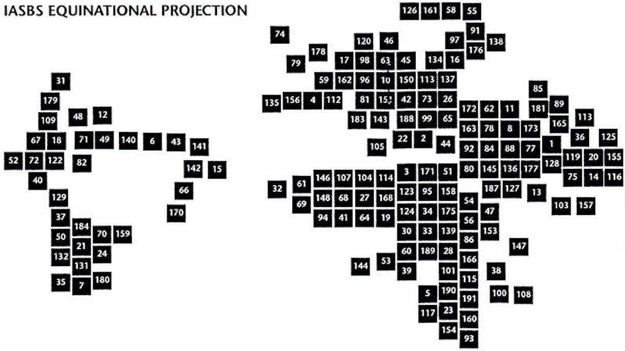
Big nations or small ones: each gets a same-sized square on this map