NASA Astronauts And Satellites Capture Breathtaking Images Of An Awakening Volcano From Space
The remote volcano Raikoke just erupted after nearly 100 years of silence. Here’s why it matters.
On June 22, 2019, a volcano that had been dormant and inactive for nearly a century suddenly sprang to life. Raikoke volcano, more commonly known as Raikoke island, has only two recorded eruptions in history: in 1924 and in 1778. But around 4:00 AM local time, a vast plume of ash and volcanic gases erupted from its central crater.
Although it’s an isolated island that’s part of a chain near the extremely active Kamchatka peninsula in eastern Asia, the new and unexpected volcanic activity was first discovered not by terrestrial monitoring, but by spaceborne satellites (and ISS astronauts) committed to observing Earth from space. While the arsenal of satellites that NASA has to monitor our planet are in constant danger of being defunded, this eruption highlights the essential need for remote Earth observing.
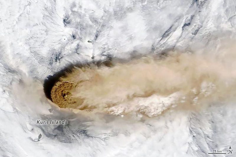
You might take a casual look at images like these and scoff at the idea that this would have any amount of practical importance. After all, a quick look at Raikoke island shows that it’s just one of a large number of similar, uninhabited volcanic islands connecting Hokkaido, Japan to Kamchatka, Russia and enclosing the Sea of Okhotsk. The Kuril islands, which Raikoke island is a part of, consist of 56 islands; only 8 are inhabited.
Sure, it might be interesting to scientists in general and to biologists and geologists in particular, as a large sea lion rookery exists there and it is a formidable stratovolcano. But beyond that, it doesn’t stand out in any particular way. It’s roughly circular, rising to a height of 550 meters (1,800 feet) above sea level, with a central, steep-walled crater that’s 200 meters (660 feet) deep.
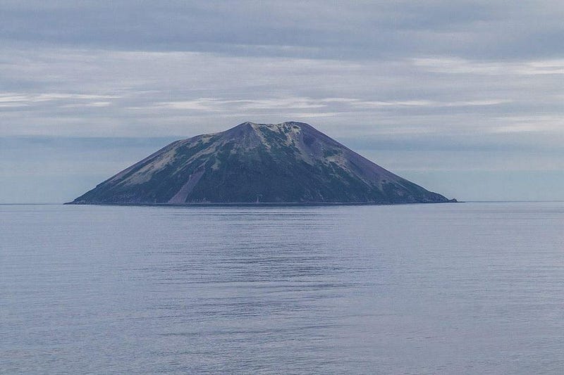
The 1778 eruption destroyed the upper third of the island, and the only other known eruptions occurred in 1924 and just a few days ago in 2019. In 1924, when it was still uninhabited, this wasn’t a big deal. But in today’s modern world, knowing where volcanoes are erupting, what they’re discharging, and monitoring where the material launched into the atmosphere goes is of paramount importance for a wide variety of reasons.
Even in uninhabited regions, volcanoes pose a tremendous threat to human activity. As populations increase, areas that are in the proximity of volcanoes are continuously being developed; more than 10,000 people live in the Kuril islands, for example. In addition, aviation routes are increasing, and planes are dramatically put at risk by volcanic eruptions. It’s only by monitoring every potential volcano, both active and inactive, that we can hope to keep humanity safe.
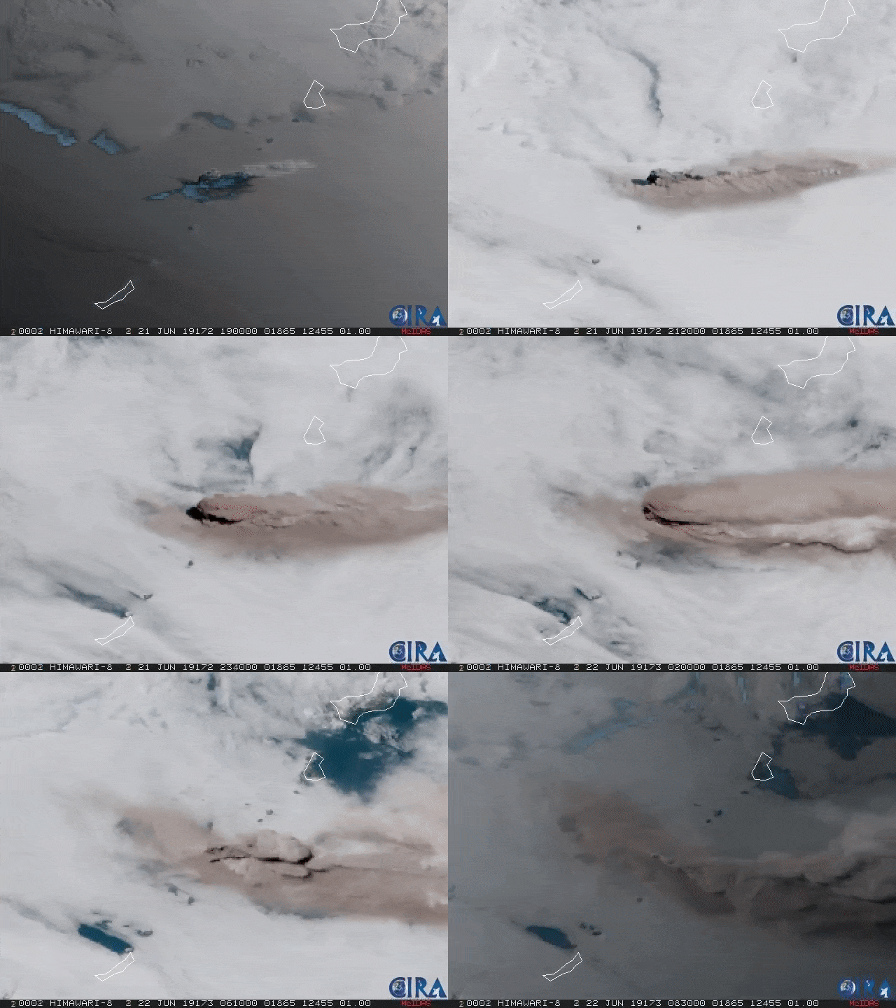
Take a look at the above animation, stitched together from the Japanese geostationary satellite Himawari 8. You can clearly see that the eruption occurs in pulses spanning many hours, and that the plumes of ash and gas rise extremely high: far above the typical cloudtops. In fact, from this remote imaging, we can determine that the plumes reached altitudes ranging from 13,000–17,000 meters (43,000–56,000 feet), which means they went beyond the troposphere and entered into the stratosphere.
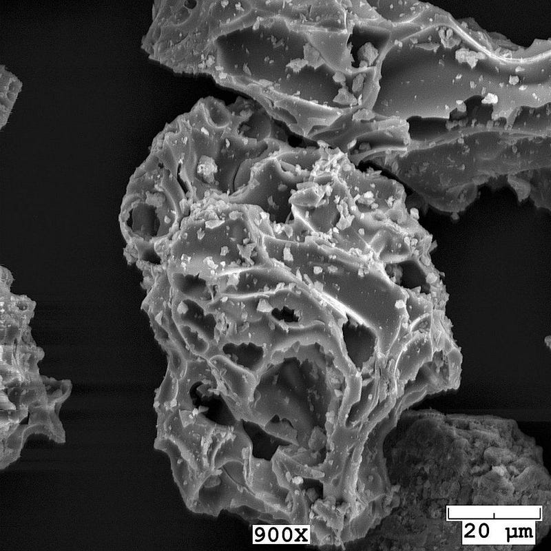
The injection of ash and sulfur dioxide into the atmosphere poses a set of substantial risks to any human inhabitants that may encounter it for a simple reason: volcanic ash isn’t actually ash, but is composes of rock, mineral, and glass fragments as small as 4 microns (μm) apiece. These solidified, microscopic fragments are hard, abrasive, corrosive, and do not dissolve in water. They can clog machinery, vents, pipes, and mammalian lungs, among numerous other hazards.
Raikoke island sits along the proverbial Ring of Fire, which has more volcanoes and hot springs along it crammed into a smaller space than any other region on Earth. If you followed the Pacific coast of Russia down the Kamchatka peninsula, it would extend down along the Kuril islands, including Raikoke island.
In fact, hundreds of volcanoes can be found along this tiny portion of the Ring of Fire, with about 10% of them being currently active. Again, monitoring these islands from space is the only way to know, in a continuous fashion, which ones are erupting at any given time and where the ash and volatile gas from those eruptions is headed at any moment.
Volcanic eruptions do more than just alter flight paths or human activity, though; they can also temporarily change our planet’s climate. Volcanic eruptions are sulfur-rich, as anyone with a working nose who’s been to a site of volcanic activity like a geyser field can tell you (from the telltale smell of rotten eggs). The eruptions will alter the land and water around them for tens of kilometers, but the drops of sulfuric acid that reach the stratosphere which reflect sunlight, modifying clouds as they fall, and produce an overall cooling effect from the emitted aerosols.
Global monitoring of volcanic eruptions has taught us this, with the particular eruption of Mount Pinatubo contributing greatly to our understanding of this topic. As far as geoenginnering solutions to climate change go, deliberate creation of stratospheric sulfur aerosols is among the leading contenders.
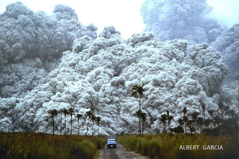
But as beautiful and breathtaking as volcanic eruptions are, they are at least as destructive. Eruptions often force people living nearby or even downwind of ashfall to abandon their homes, sometimes permanently. The long-term and long-ranging effects can include damage from ash, flooding, tephra and other volatiles. This damage can affect agriculture, urban areas, industrial plants and any type of machinery, transportation systems and flight paths, and even electrical grids.
The biggest weapon humanity has against them? Volcanic monitoring, which can give us the greatest amount of lead time in determining how to best mitigate the damage to human populations and communities. In situ monitoring is a start, but nothing compares to the power of continuous Earth observing from space.
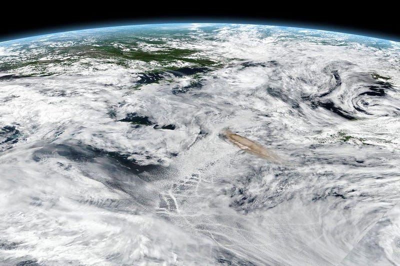
Volcanic Ash Advisory Centers from Tokyo to Anchorage can track plumes from volcanic eruptions in this region of the world very closely, telling aviators where they should and shouldn’t fly, a vital function considering what ash can do to machinery. Satellite data from a variety of instruments and spacecraft, from NASA’s Terra to Suomi NPP to CALIPSO to Himawari 8 and more can track not only the ash but volcanic gases, with stratospheric (rather than tropospheric) plumes posing longer-term risks to aviation and greater effects on the climate.
It’s important to recognize that monitoring the Earth for hazards such as this is truly a global endeavor, and requires international cooperation and collaboration to minimize the impacts to humanity.
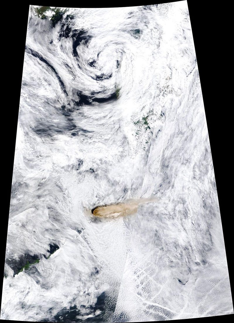
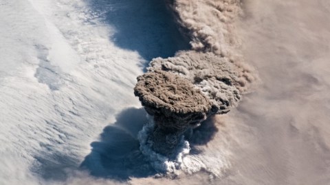
By taking advantage of constant imaging from space, scientists can track how rising volcanic plumes, such as the one emitted from Raikoke island, behave. The plume in this particular eruption rose in a narrow, vertical column, and then spread out to form what’s known as an umbrella region.
This occurs when the density of the plume, which is typically low, becomes equal to the density of the surrounding air, which decreases at progressively higher altitudes. When the densities match, the volcanic plume stops rising. The best view of this comes from relatively low altitudes, however: low-Earth orbit as opposed to geostationary orbit. That’s why the most spectacular view of this eruption of all comes from astronauts aboard the International Space Station.
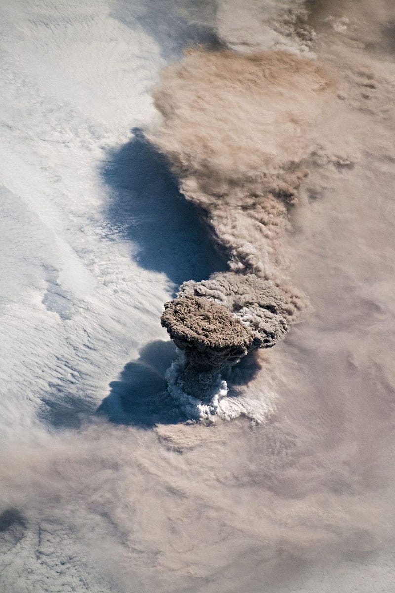
In the image above, the volcanic plume can be seen breaking through the clouds, forming a ring at the base of the column which is very likely to be water vapor. For how this works, we can look to volcanologist Simon Carn, who elucidates:
The ring of white puffy clouds at the base of the column might be a sign of ambient air being drawn into the column and the condensation of water vapor. Or it could be a rising plume from interaction between magma and seawater because Raikoke is a small island and flows likely entered the water.
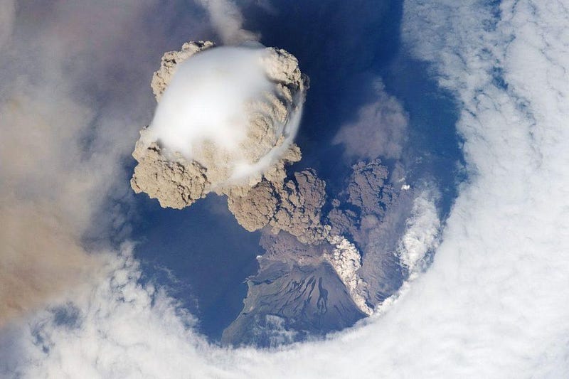
For those of you who closely follow the most spectacular photos of volcanic eruptions as seen from space, it might be reminiscent of another eruption that occurred in the Kuril islands almost exactly a decade ago: the June 12, 2009 eruption of Sarychev volcano.
Volcanoes are some of the most fascinating but also dangerous and deadly natural disasters. Fortunately, with appropriate monitoring, they’re one of the most easily mitigated classes of disasters as well. There are approximately 1,500 potentially active volcanoes on Earth at any time, which doesn’t include undersea volcanoes that have not reached the surface or inactive ones that might surprise us.
Only by continuously monitoring the entire Earth at the appropriate resolutions and cadences can we hope to truly minimize the risk to human life and property. Attempts to cut back on this endeavor harm and endanger us all, while an awareness and appreciation for what Earth observing brings us is our greatest asset. May the beauty of these pictures point the way to the most important truth: that comprehensive knowledge and more information are absolutely key to optimally navigating the challenges of being human on our living planet Earth.
Ethan Siegel is the author of Beyond the Galaxy and Treknology. You can pre-order his third book, currently in development: the Encyclopaedia Cosmologica.


